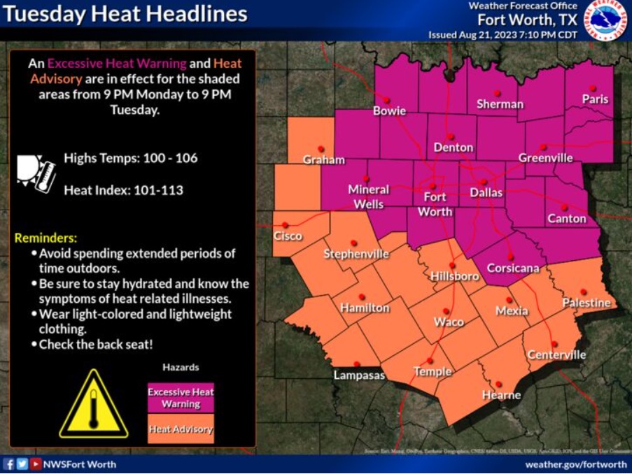
Excessive Heat Warning and Heat Advisory are both in effect through 9 PM today. Make sure to practice heat safety by drinking plenty of water, avoiding excess time outdoors during the heat of the day, and knowing the signs of heat illness.
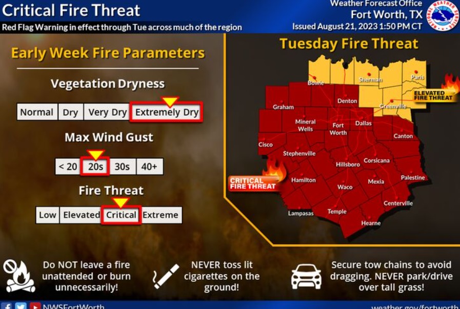
Texas (WBAP/KLIF) Persistent hot and dry conditions with breezy east-southeasterly winds will lead to critical fire weather conditions across much of North and Central Texas during the early portions of this week. A Red Flag Warning is in effect through Tuesday evening for locations south and west of the I-35 and I-20 corridors. Avoid any outdoor activities that could lead to new fire starts as conditions will be supportive of rapid wildfire growth and spread!
Forecast:
Tuesday
Sunny and hot, with a high near 105. Heat index values as high as 110. South southeast wind 5 to 15 mph becoming east in the afternoon.
Tuesday Night
Mostly clear, with a low around 83. East wind 5 to 10 mph becoming south southwest after midnight.
Wednesday
Sunny and hot, with a high near 104. Heat index values as high as 111. Southwest wind 5 to 10 mph becoming east southeast in the afternoon.
Wednesday Night
Mostly clear, with a low around 85. East southeast wind around 5 mph becoming south southwest after midnight.
Thursday
Sunny and hot, with a high near 107. West southwest wind around 5 mph.
Thursday Night
Mostly clear, with a low around 85. East southeast wind around 5 mph becoming south southwest after midnight.
Friday
Sunny and hot, with a high near 109. Southwest wind 5 to 10 mph becoming northeast in the afternoon.
Friday Night
Partly cloudy, with a low around 84. Southeast wind around 10 mph becoming south southwest after midnight.
Saturday
Sunny and hot, with a high near 107.
Saturday Night
Mostly clear, with a low around 83.