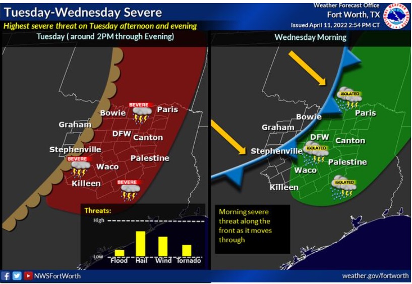
Some storms may be severe with large hail as the main threat, though damaging winds and a tornado or two are possible. Storm chances will end from west to east Wednesday with the passage of a cold front. There is a morning severe risk along the front as it passes through.
Forecast:
Tuesday – A 50 percent chance of showers and thunderstorms, mainly after 1pm. Some of the storms could be severe. Mostly cloudy, with a high near 85. South wind 15 to 20 mph, with gusts as high as 30 mph. New rainfall amounts of less than a tenth of an inch, except higher amounts possible in thunderstorms
.Tuesday Night – A 30 percent chance of showers and thunderstorms after 1am. Partly cloudy, with a low around 68. South wind 15 to 20 mph, with gusts as high as 35 mph.
Wednesday – A 20 percent chance of showers and thunderstorms before 1pm. Mostly cloudy through mid morning, then gradual clearing, with a high near 84. South southwest wind 15 to 20 mph becoming west northwest in the afternoon. Winds could gust as high as 30 mph.
Wednesday Night – Clear, with a low around 50. West northwest wind 10 to 15 mph becoming east northeast 5 to 10 mph after midnight. Winds could gust as high as 25 mph.
Thursday – Sunny, with a high near 79. East southeast wind 5 to 10 mph.